Unlocking the Great Smoky Mountains: The Ultimate Guide to the Park’s Top Sights
Discover the Magic of America’s Most Visited National Park—at Your Own Pace, on Your Own Terms
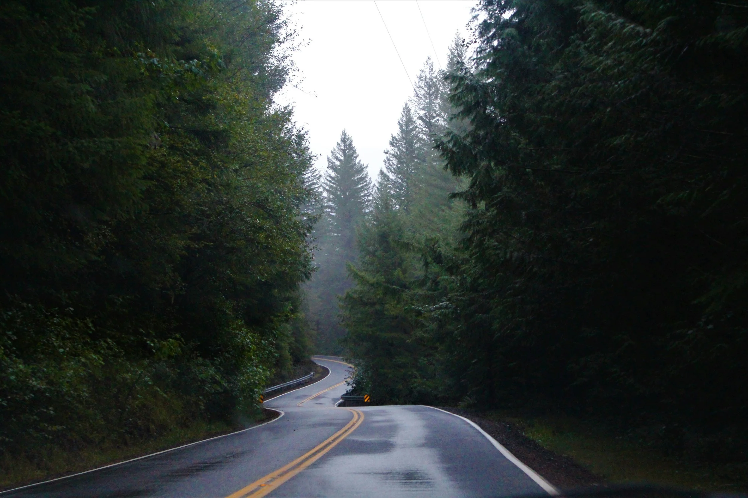
The Smokies offer an intoxicating blend of natural beauty and rich cultural heritage — Kaleb Brown / Unsplash
There is a reason the Great Smoky Mountains National Park draws more visitors than any other national park in the United States. Straddling the rugged border between Tennessee and North Carolina, this ancient mountain range is draped in a signature blue mist—an ethereal fog created by the collective respiration of millions of trees. From sweeping, panoramic vistas and plunging waterfalls to historic Appalachian settlements and abundant wildlife, the Smokies offer an intoxicating blend of natural beauty and rich cultural heritage.
But here is the secret to truly experiencing the magic of the mountains: you cannot rush them. The Great Smoky Mountains reveal their best-kept secrets to those who take their time. If the idea of being herded onto a crowded tour bus, forced to adhere to a rigid schedule, or straining to hear a guide over the chatter of thirty strangers sounds like the opposite of a vacation, you are in the right place.
Exploring the Smokies is about the freedom of the open road. It’s about pulling over when you spot a black bear cub in a meadow, spending an extra twenty minutes admiring a cascading waterfall, and diving deep into the history of the land on your own schedule.
Whether you are planning your first trip or your fifth, here are the top five must-see attractions in the Great Smoky Mountains—and how to experience them on your own terms.
Echoes of the Mist: Key Stops in the Smokies

Navigate the Great Smoky Mountains on your own terms with Drives & Detours — A n v e s h / Unsplash
Exploring America's most visited national park requires leaving the tour buses behind to find its quiet, historic corners and high-altitude vistas. This overview captures the essential sights and independent strategies needed to navigate the Great Smoky Mountains on your own terms.
Cades Cove: An 11-mile historic valley loop showcasing preserved 19th-century pioneer cabins, primitive churches, and premier early-morning opportunities to spot wild turkeys, deer, and black bears
Kuwohi (Clingmans Dome): The highest crest in the park at 6,643 feet, offering a steep paved climb to a 360-degree observation tower surrounded by a cool, fragrant spruce-fir forest
Roaring Fork Motor Nature Trail: A narrow, winding 5.5-mile single-lane loop that hugs rushing mountain streams, passing historic farmsteads and trailheads for deep-forest waterfall hikes
Laurel Falls: An iconic 80-foot cascading waterfall reached via a moderate, 2.6-mile paved round-trip trail that comes alive with blooming mountain laurel in late spring
Newfound Gap: The historic, high-elevation mountain pass straddling the Tennessee-North Carolina border where visitors can stand at the site of FDR’s 1940 dedication or step onto the Appalachian Trail
The Autonomy Strategy: The art of arriving at dawn to beat peak traffic, packing a private lunch to escape roadside crowds, and adjusting your timeline dynamically as weather shifts over the ridges
1. Cades Cove: A Valley Suspended in Time
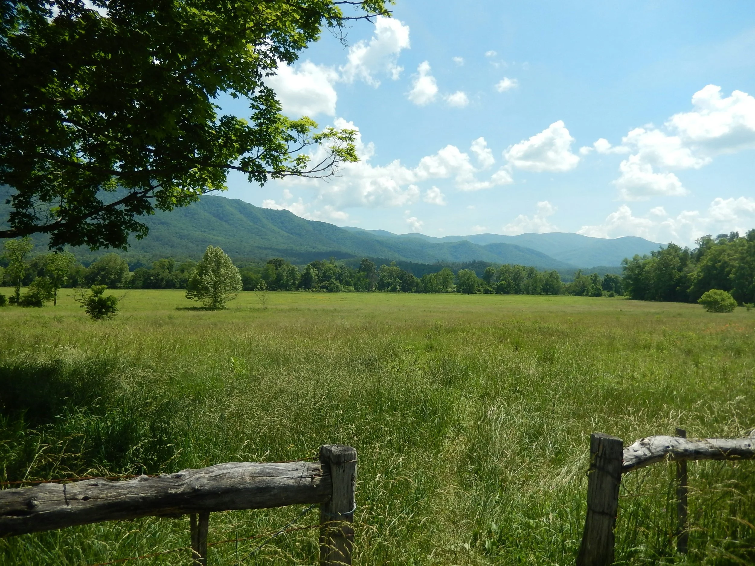
Cades Cove is one of the best places to spot wildlife in the eastern United States — Angela Loria / Unsplash
If you only have time for one major stop in the park, make it Cades Cove. Nestled in an isolated valley surrounded by towering peaks, this sprawling expanse offers some of the best wildlife viewing in the eastern United States.
The primary way to experience the valley is via the Cades Cove Loop Road, an 11-mile, one-way scenic drive that winds through sweeping meadows and dense forests. As you navigate the loop, you will pass a fascinating collection of preserved historic structures from the 18th and 19th centuries. You can step out of your vehicle to explore the John Oliver Cabin, historic churches, and a fully functioning grist mill, gaining a profound understanding of what pioneer life was like in the isolation of Appalachia.
The Independent Traveler's Tip: Cades Cove is immensely popular, which means traffic on the loop can slow to a crawl during peak afternoon hours. Because you are setting your own schedule, plan to arrive right at sunrise. Not only will you beat the heavy traffic, but the early morning hours offer the absolute best chance to spot white-tailed deer, wild turkeys, and the park’s famous black bears foraging in the mist. Furthermore, from May through September, the loop is closed to motor vehicles on Wednesday, making it a paradise for cyclists and pedestrians.
2. Clingmans Dome (Kuwohi): Touching the Sky
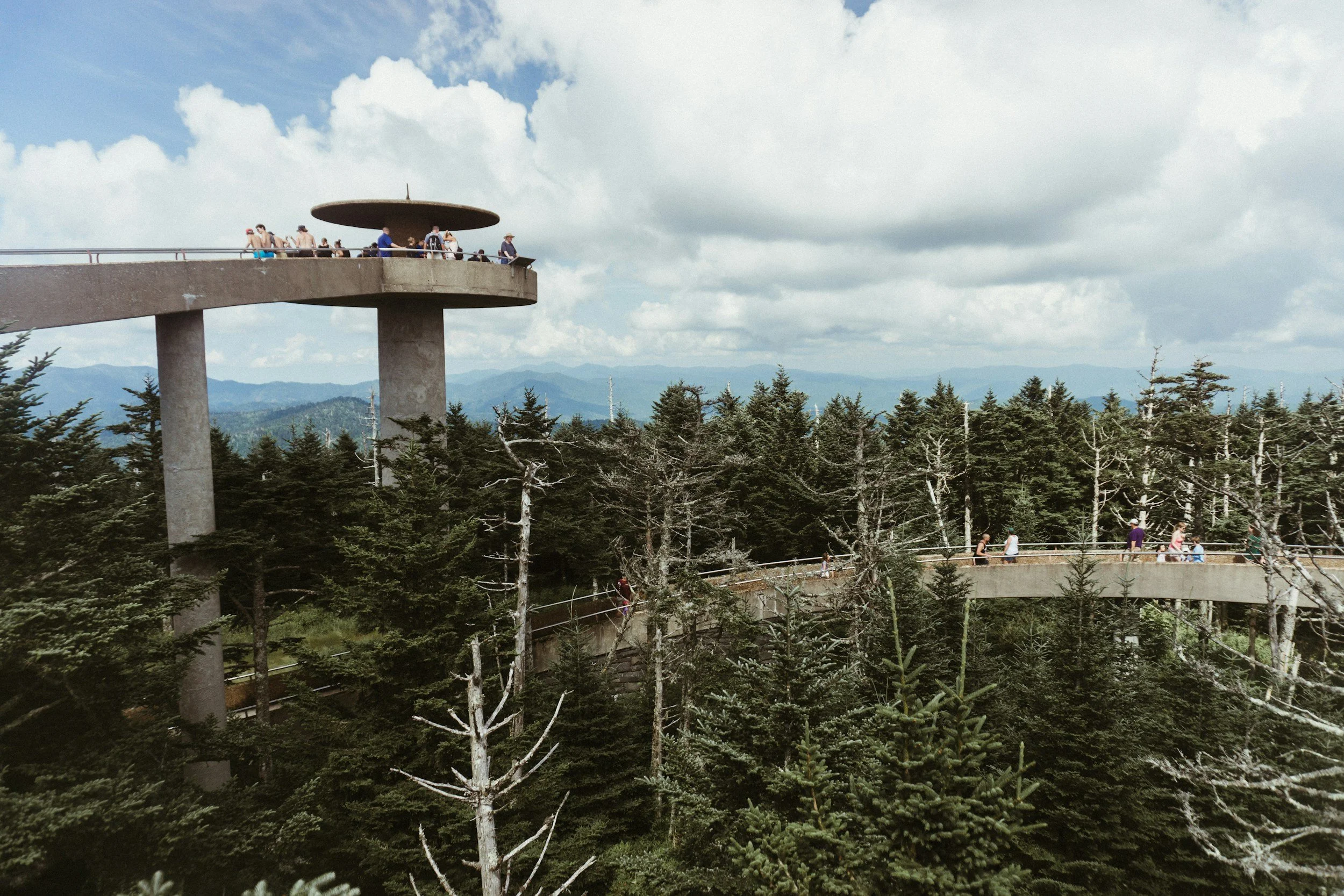
The view from the observation tower on top of Kuwohi stretches for more than 100 miles on a good day — Kirk Thornton / Unsplash
To truly understand the scale of the Great Smoky Mountains, you have to head to the top. At 6,643 feet, Clingmans Dome—recently restored to its traditional Cherokee name, Kuwohi—is the highest point in the national park, the highest point in Tennessee, and the third-highest peak east of the Mississippi River.
The drive to the summit along Clingmans Dome Road is an experience in itself. As you ascend, you will notice a distinct shift in the ecosystem. The familiar oak and hickory trees give way to a dense, fragrant spruce-fir forest that feels more like you are driving through Canada than the American South.
Once you reach the parking area, a steep, half-mile paved trail leads to a stunning concrete observation tower. On a clear day, the panoramic views from the top can expand up to 100 miles, allowing you to gaze across seven different states.
The Independent Traveler's Tip: The temperature at the summit of Kuwohi can be 10 to 20 degrees cooler than in the surrounding gateway towns like Gatlinburg. Since you aren't waiting on a group, you have the flexibility to wait out passing clouds or visit during the golden hour just before sunset, when the shifting light paints the mountain ridges in brilliant shades of orange and purple.
3. Roaring Fork Motor Nature Trail: A Rainforest on Wheels
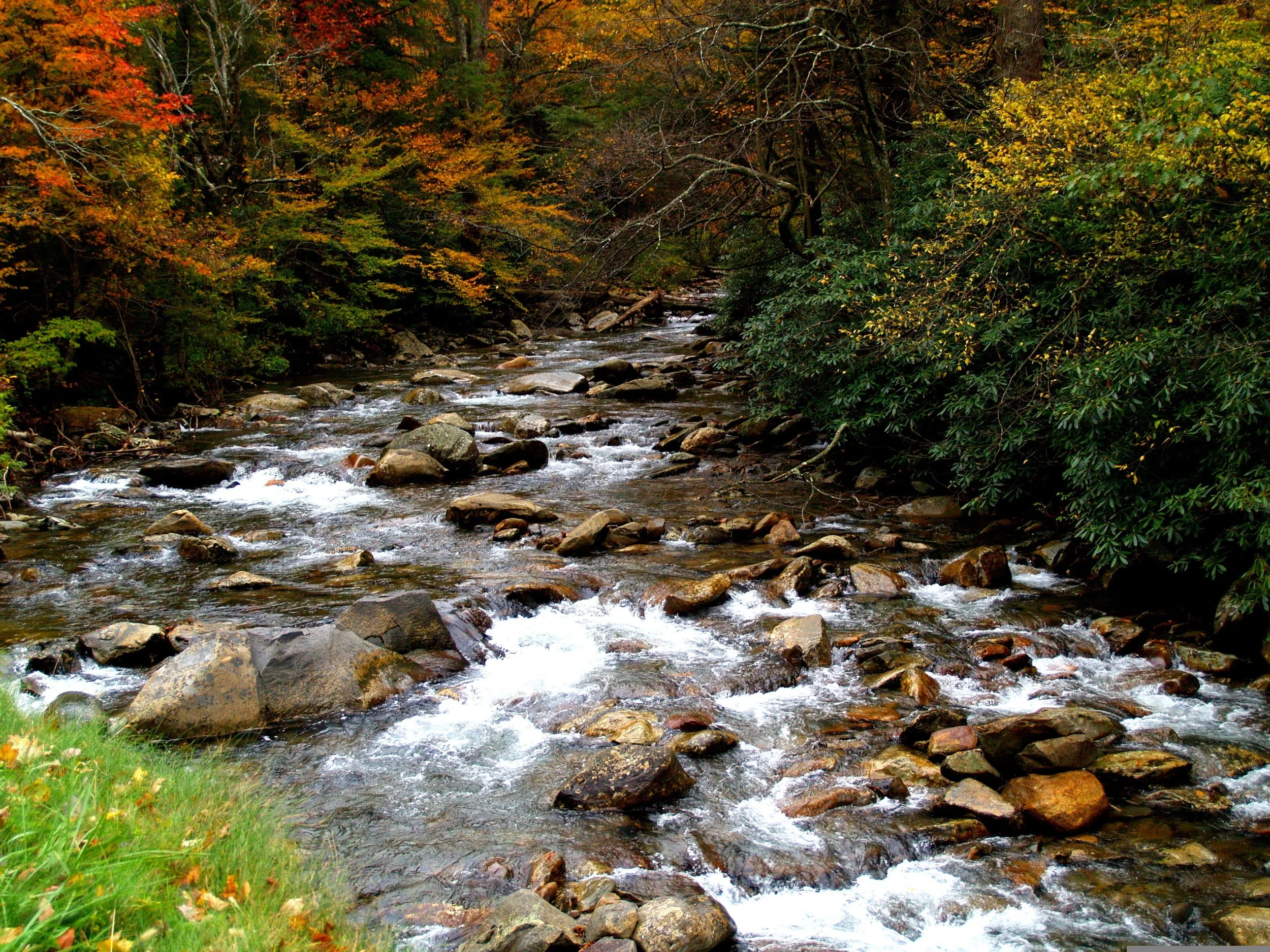
Roaring Fork plunges you into a lush, secondary-growth forest — Elle Ritter / Pixabay
For those who love the thrill of a winding mountain road, the Roaring Fork Motor Nature Trail is an absolute must-do. Located just minutes from downtown Gatlinburg, this 5.5-mile, one-way loop road plunges you into a lush, secondary-growth forest that feels worlds away from civilization.
Named for the fast-flowing mountain stream that runs alongside the road, Roaring Fork is famous for its vibrant green foliage, rushing cascades, and rich history. Along the route, you can explore the Noah "Bud" Ogle place, an authentic mountain farmstead, and access the trailheads for some of the park's most beloved waterfall hikes, including Rainbow Falls and Grotto Falls.
The Independent Traveler's Tip: This narrow, winding road moves at a leisurely pace, and motorhomes, buses, and trailers are strictly prohibited. This makes it the ultimate sanctuary for independent drivers. Roll your windows down, turn up an immersive audio guide, and let the sounds of the rushing river and the scent of damp earth and pine fill your car.
4. Laurel Falls: The Crown Jewel of Cascades
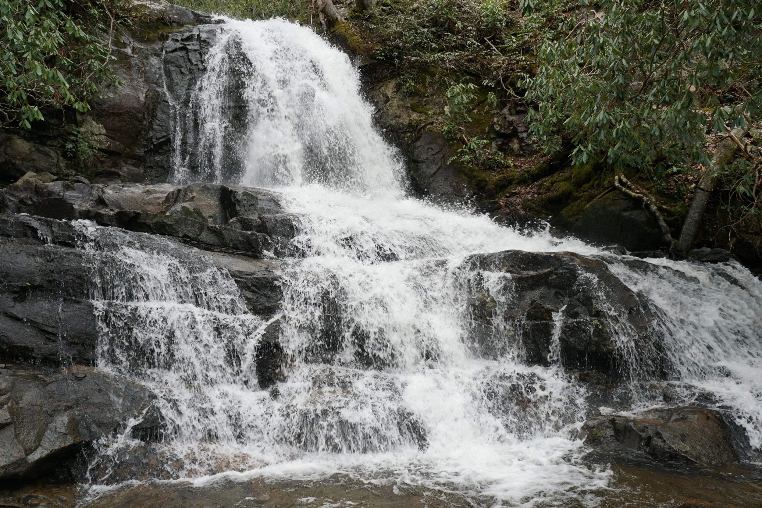
Laurel Falls is a crwon jewel of the Smoky Mountains, and can be seen after a moderate hike — Herbert Sennett / Pexels
The Smoky Mountains are home to dozens of spectacular waterfalls, but Laurel Falls stands out as the crown jewel. Named for the vibrant mountain laurel that blooms brilliantly along the trail in the month of May, this magnificent 80-foot cascade is divided into an upper and lower section, divided by a picturesque walkway crossing the stream at the base of the upper falls.
The trail to Laurel Falls is 2.6 miles round-trip and is one of the few paved trails in the national park—a measure originally taken in the 1960s to prevent erosion from heavy foot traffic. The hike is considered moderate, making it highly accessible for families and casual hikers who want a big reward for a relatively short trek.
The Independent Traveler's Tip: When you aren't beholden to a tour guide's umbrella, you can take your time navigating the uneven portions of the pavement and spend as long as you want photographing the falls. Bring a packed lunch, find a safe, sturdy rock downstream, and enjoy a private picnic accompanied by the sound of rushing water.
5. Newfound Gap and the Appalachian Trail: Straddling the State Line
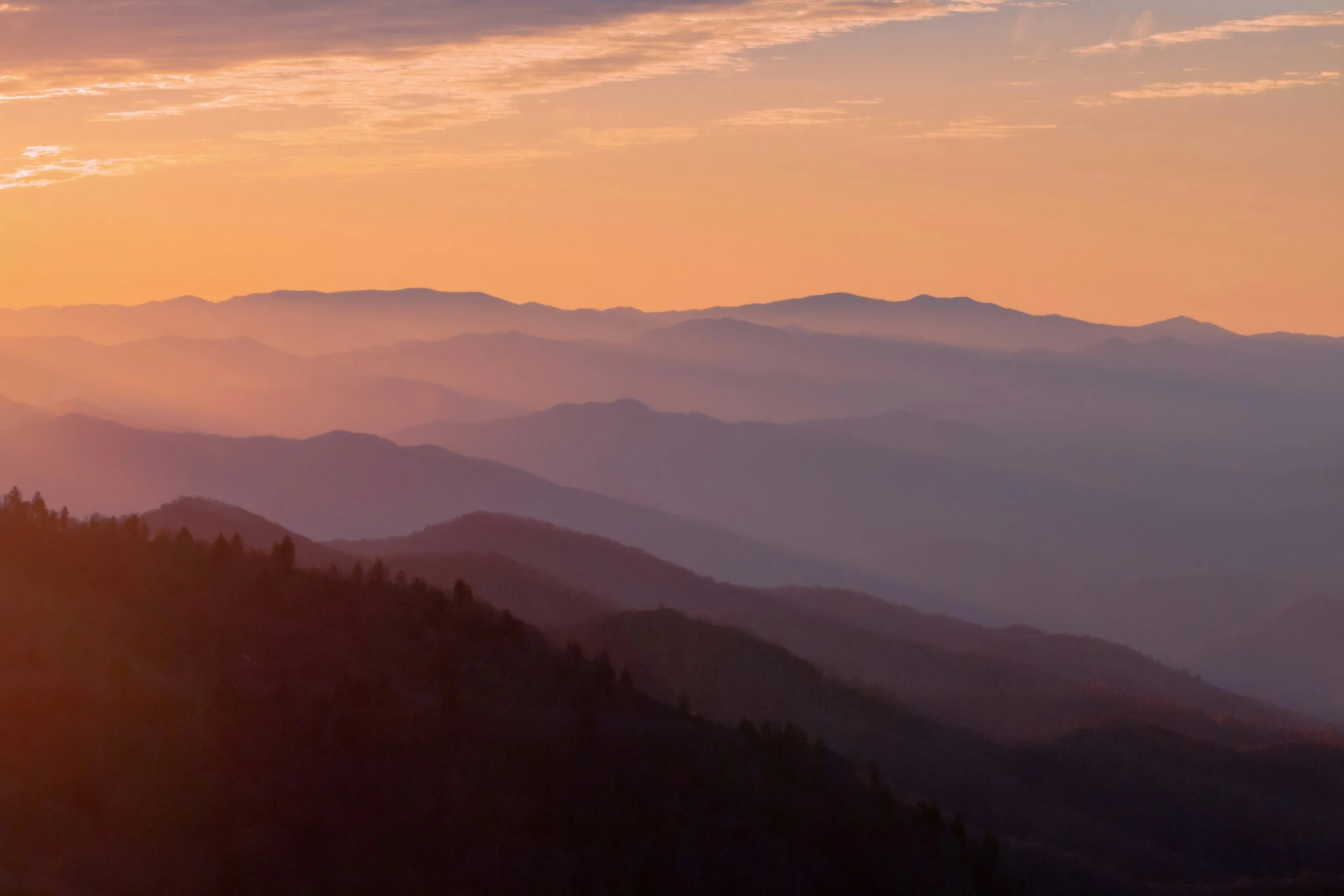
Newfound Gap offers endless views and staggering overlooks — Jonny James / Unsplash
At an elevation of 5,046 feet, Newfound Gap is the lowest drivable pass through the Great Smoky Mountains and the iconic center point of the park. The scenic drive along Newfound Gap Road (Highway 441) is a 33-mile stretch that bisects the park, offering endless pull-offs and staggering mountain overlooks.
At the gap itself, you will find the Rockefeller Memorial, the historic site where President Franklin D. Roosevelt officially dedicated the national park in 1940. It is also here that the state line physically divides Tennessee and North Carolina, providing a fun photo opportunity where you can stand with one foot in each state.
Perhaps most exciting for outdoor enthusiasts, Newfound Gap intersects with the world-famous Appalachian Trail.
The Independent Traveler's Tip: You don't have to be a seasoned backpacker to experience the magic of the A.T. Because you are traveling on your own schedule, you can easily park at Newfound Gap, hop onto the Appalachian Trail for a mile or two, and proudly say you've hiked a portion of the legendary 2,200-mile footpath that stretches from Georgia to Maine.
Experience the Smokies the Drives & Detours Way

Explore the Great Smoky Mountains with Drives & Detours
The Great Smoky Mountains were meant to be explored with a sense of wonder and freedom. But choosing to travel independently doesn't mean you have to miss out on the rich history, local legends, and hidden secrets that make this park so special.
That is where we come in.
With the Drives & Detours Great Smoky Mountains Scenic Drive, you get the best of both worlds. You get the deep, expertly curated knowledge of a seasoned local guide, seamlessly combined with the absolute freedom of a self-guided road trip.
There are no crowded buses. There is no rigid itinerary. There is no rushing through a historic cabin because a tour guide is blowing a whistle.
Instead, our GPS-triggered audio app transforms your own vehicle into a private tour experience. As you drive toward Cades Cove, climb to Clingmans Dome, or wind through the Roaring Fork Motor Nature Trail, the app automatically plays fascinating stories, historical context, and crucial navigational tips exactly when you need to hear them. If you want to pull over for a two-hour hike, the tour simply pauses. When you get back in the car and start driving, it picks right back up where you left off.
You are the captain of your own adventure. We just provide the ultimate soundtrack.
Ready to leave the tour buses in the rearview mirror? Download the Great Smoky Mountains Scenic Drive today and discover America's most visited national park the way it was meant to be seen.
Frequently Asked Questions About the Great Smoky Mountains
When is the best time to visit Cades Cove to avoid heavy traffic?
To beat the midday gridlock, plan to arrive right at sunrise when wildlife is most active and the valley fog is clearing. Additionally, from May through September, the loop road is completely closed to motor vehicles on Wednesdays, making it a peaceful sanctuary for cyclists and pedestrians.
Why does the forest change so drastically on the drive up to Kuwohi?
As you ascend toward the summit, the elevation creates a rapid drop in temperature and an increase in moisture. The lower oak and hardwood forests give way to a dense, fragrant spruce-fir canopy, forming a unique southern Appalachian boreal ecosystem that closely mirrors the forests of eastern Canada.
Are commercial vehicles or large RVs permitted on all the park's scenic drives?
No. Certain historic routes, most notably the Roaring Fork Motor Nature Trail, are exceptionally narrow, steep, and winding. Because of these tight clearances and sharp turns, buses, motorhomes, and trailers are strictly prohibited, keeping the road clear for standard passenger vehicles.
What should I expect from the terrain on the hike to Laurel Falls?
While the 2.6-mile round-trip trail to the waterfall was paved in the 1960s to manage foot traffic and prevent erosion, it is not perfectly flat. The pavement has become rough, cracked, and uneven over time, meaning it still requires stable footwear and a steady pace, especially for families with young children.
How drastically does the weather vary between the gateway towns and the mountain peaks?
The temperature at high-altitude spots like Newfound Gap and Kuwohi can be 10 to 20 degrees cooler than in low-elevation gateway hubs like Gatlinburg or Townsend. Independent travelers should always carry an extra layer or a light rain jacket in the car, as sudden mist, wind, and temperature drops are common along the crestline.